|
|||
| Previous Page | Home | Table of Contents | Next Page |
| Runoff Report 1999..... Mild Winter |  |
|
|
|
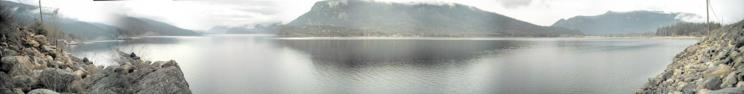
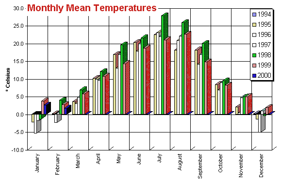
A winter with mild temperatures can also have its effect on the following runoff. The tendency during mild winters is towards more snowfall, which means higher water potential. A higher snowpack extends the first two stages of the runoff with increased flood danger and higher peak in the second stage. A higher snowpack has no effect on the third runoff stage. This is explained in the earlier chapter describing the physics of snowmelt. But a warmer winter brings also some relief for the runoff. Snow in lower altitudes can melt down during sunny days reducing the height of the snowpack. The spring starts usually earlier, initiating an early runoff start. I call this an invisible runoff because the melting power of the sun isn't strong enough to melt a significant amount of snow in a short period of time. Therefore, the streams and lakes don't show a noticeable change. The soil also remains unfrozen during mild winters. This allows the subsurface flow of snow water reducing its overall speed of flow. I will come back to that a little later in this report. A very good example for this invisible runoff effect is the current winter of 1999/2000. In January snowfall caused a fairly high snowpack in lower altitudes around the Shuswap Lake. By the end of February at least half of the snowpack was melted away without even showing any indication of that besides the reduced snow mass. Lakes and streams remained normal. Unfrozen soil allowed subsurface flow, the ground and small buffer zones remained dry. The invisible runoff has already started by the end of January taking an essential part of water out of the coming first runoff stage. The following graph shows some monthly mean temperatures for the previous years. |
|
 |
|
Back to the runoff 1999. As shown in the graph the mean temperature for December 1998 was cold, below freezing point. The snowpack couldn't be reduced, snowfall accumulated. The following January brought warm temperatures initiating an invisible runoff, capable of reducing the low altitude snowpack. This effect was decreased and partially interrupted during a cooler February, but started again in March 1999. By the end of March the temperatures were high enough to start the first stage of the runoff. Reducing the low altitude snowpack during the winter led to a short first runoff stage. In the first week of May the low altitude snowpack was gone. A subsurface flow continued to bring snow water into the lake, but limiting the total lake inflow for about 2 weeks. The lake level increase slowed down, almost balancing the inflow / outflow relation. Warm periods had no effect on the medium altitude snowpack before the last week of May, when the second runoff stage started. This gap of 2 weeks between the first and second runoff stage is the result of the snowmelt during the winter causing the lake inflow running out of supply. The second stage could start at a lower lake level and therefore directly lowering the peak level in the progress, basically by extending the runoff time span (as explained in this report earlier). Without the gap between the first and second runoff stage the time span would have been shorter, pushing the peak level even higher. And, of course, creating more problems for this region. |
|
| === Top of Page === | |
|
Copyright (C) 2003 Bernhard Kramer, Sicamous, BC - Canada webmaster@shuswaplakewatch.com |
|