|
||
| Home | The Snow Melting Process | Runoff Report 1999 |
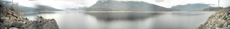
The Shuswap Lake Facts The Shuswap Lake, located in the center of southern British Columbia, Canada, is a joint lake system consisting of
Wide, open connections make it behave like a single unit. Surface level changes always apply to the whole lake system. Therefore, the name Shuswap Lake as used in this research always points the complete lake system as listed above. |
||||||||||||||||||||||||||||||||||||||||||||||||||||||||||||||||||||||||||||||||||||||||||||||||||||||||||||||||||||||||||||||||||||||||||||||||||||||
 |
||||||||||||||||||||||||||||||||||||||||||||||||||||||||||||||||||||||||||||||||||||||||||||||||||||||||||||||||||||||||||||||||||||||||||||||||||||||
Shuswap Lake System:
Other Lakes Feeding Water into the Shuswap Lake:
|
||||||||||||||||||||||||||||||||||||||||||||||||||||||||||||||||||||||||||||||||||||||||||||||||||||||||||||||||||||||||||||||||||||||||||||||||||||||
| The Shuswap Lake is the center point of a large stream and lake network. Approximately 526 streams and lakes, covering a runoff area of about 25,000 square km, contribute their water into the Shuswap Lake. The South Thompson River, the only outlet of the Shuswap Lake system, carries the total intake about 500 km west through British Columbia where it is finally released into the Pacific Ocean near Vancouver. The Shuswap Lake acts as buffer zone and regulator for the outflow. The amount of water released into the South Thompson River is regulated by the lake level itself. This allows very precise and reliable calculations about the water mass released downstream. Three major inflows (Shuswap River, Eagle River and Salmon River) are located at the opposite end from the outflow. This causes a constant flow of water through the complete lake system based on the combined water mass of those streams. The complete watershed behind the Shuswap Lake is a complicated but well-regulated network of streams and lakes. Many small and medium sized lakes act as buffer zones during the initial runoff before allowing a throughput of nearly 100%. Currently there are no data available to analyze certain behavior patterns or its relevance during the runoff and therefore will be a future project of this research. The Sugar Lake is the only intentionally regulated watershed. The outflow, a continuum of the Shuswap River, is controlled by a dam and maintained by BC Hydro as power generator station. |
||||||||||||||||||||||||||||||||||||||||||||||||||||||||||||||||||||||||||||||||||||||||||||||||||||||||||||||||||||||||||||||||||||||||||||||||||||||
|
Streams and lakes covered by this research: (526 items, list not yet complete) To view the full list, click here Source: Watershed Dictionary, BC Ministry of Fisheries |
||||||||||||||||||||||||||||||||||||||||||||||||||||||||||||||||||||||||||||||||||||||||||||||||||||||||||||||||||||||||||||||||||||||||||||||||||||||
| === Top of Page === | ||||||||||||||||||||||||||||||||||||||||||||||||||||||||||||||||||||||||||||||||||||||||||||||||||||||||||||||||||||||||||||||||||||||||||||||||||||||
|
Copyright (C) 2003 Bernhard Kramer, Sicamous, BC - Canada webmaster@shuswaplakewatch.com |
||||||||||||||||||||||||||||||||||||||||||||||||||||||||||||||||||||||||||||||||||||||||||||||||||||||||||||||||||||||||||||||||||||||||||||||||||||||